About
ECOSENSUS was an e-Social Science project funded by the ESRC (2005-2007). It built on, and involved members of, the Guyana Darwin Initiative Project. The context for environmental decision making was provided by the Makushi tribal region, situated in the Rupununi River catchment, Guyana, which is the size of S.E. England and contains one of the highest diversity of animal and plant species in the world. This region is also under intense pressure to expand the exploitation of its natural resources, including timber, gold, and commercially viable fish species. The Guyana Darwin Initiative Project is developing geospatial and socio-ecological databases and models as baseline data for monitoring and planning in the region. The challenge for the Darwin Project is to produce a monitoring and management plan that will allow the sustainable exploitation of these resources while directly benefiting the long-term interests of the local Makushi community.
The project objectives were:
- To develop a distributed computational infrastructure that extends conventional geographical information systems functionality with support for continued collaborative sensemaking: analysis, discussion, conceptual modelling and commitment to action on behalf of vulnerable communities in endangered ecosystems; and
- To develop the capacity for such distributed, spatial decision-support both within the UK and at international level through training and an on-line distance-learning, open-source short-course (contributing credit points towards at least two existing OU postgraduate programmes and similar programmes at the Royal Holloway College, University of London and the University of Guyana).
The project used Critical System Heuristics and Soft Systems Methodology. ECOSENSUS integrated a state of the art Geographical Information System called ‘User-friendly Desktop Internet GIS’ or uDig with the Compendium dialogue mapping tool in order to assist the Makushi Amerindian tribespeople, who live in the Rupununi region of Guyana, to better negotiate, understand and discuss their natural resource conservation and livelihood improvement needs, by providing distributed decision-making support.
The Software
The uDig platform was an existing Eclipse application that the Ecosensus project extended to integrate it with the Compendium dialogue mapping tool.
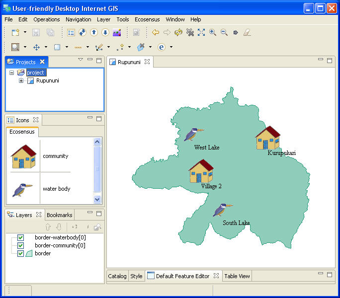
Figure 1. uDig Ecosensus extended interface
In Figure 1 you can see the uDig Ecosensus extended interface showing a map where various Rupununi geographical features have been mapped out.
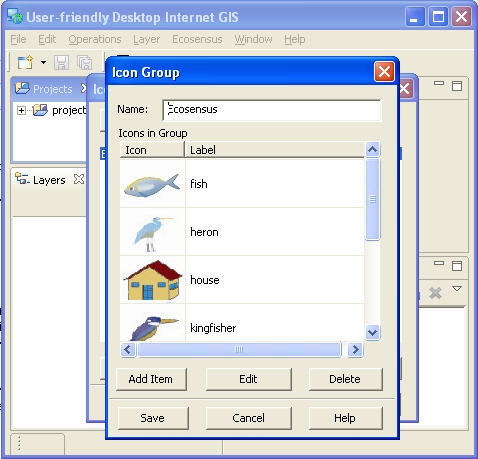
Figure 2. uDig Ecosensus icon palette
A special icon set that was developed for use in the Ecosensus project.
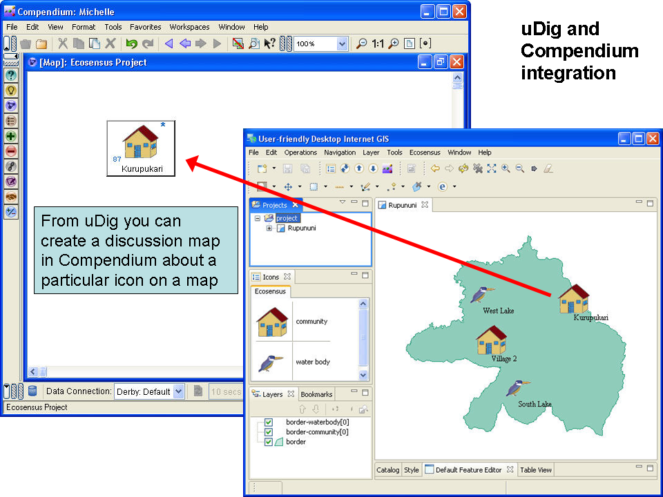
Figure 3. uDig Ecosesnus extended interface opening to a related Compendium map
From any mapped icon in uDig you could start or open a Compendium discussion, assuming Compendium was installed on the same computer as the Eclipse uDig software was running. Conversations around that geographical feature could then be captured in Compendium.
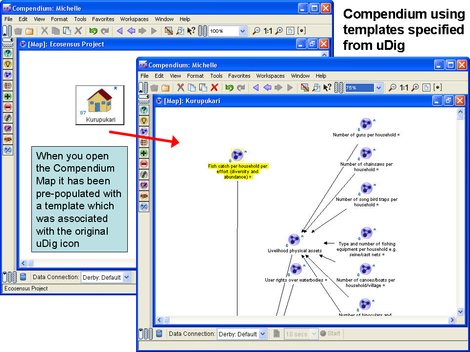
Figure 4. Open a Compendium map to view details of the discussion
Each Ecosensus uDig icon had a pre-defined Compendium discussion templated associated with it. So when a new discussion was started around a given geographical feature type (icon), a Compendium discussion map would be created and pre-populated with the associated discussion template. In Figure 4 you can see an example of a Compendium discussion map created around a specific Rupununi geographical feature, in this example a village.
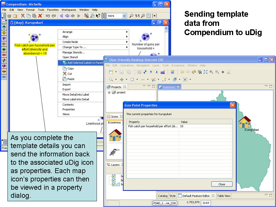
Figure 5. Screenshots showing how Compendium discussion items could become uDig map icon properties
Any Compendium discussion item could be set as a property against the corresponding uDig map icon, so key information from the discussion could also be seen inside uDig.
All this required the development of two-way communication between Compendium and the uDig Ecosensus platform and the creation of a syntax for how the information would be passed and interpreted by each peice of software.
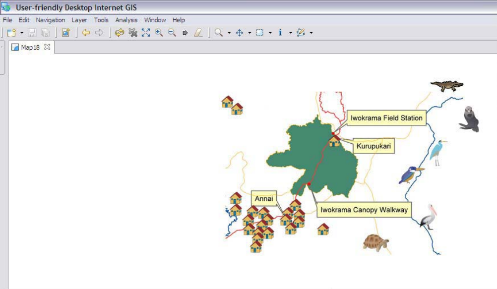
Figure 6. A larger example of a uDig Ecosensus map of the Rupununi River catchment.
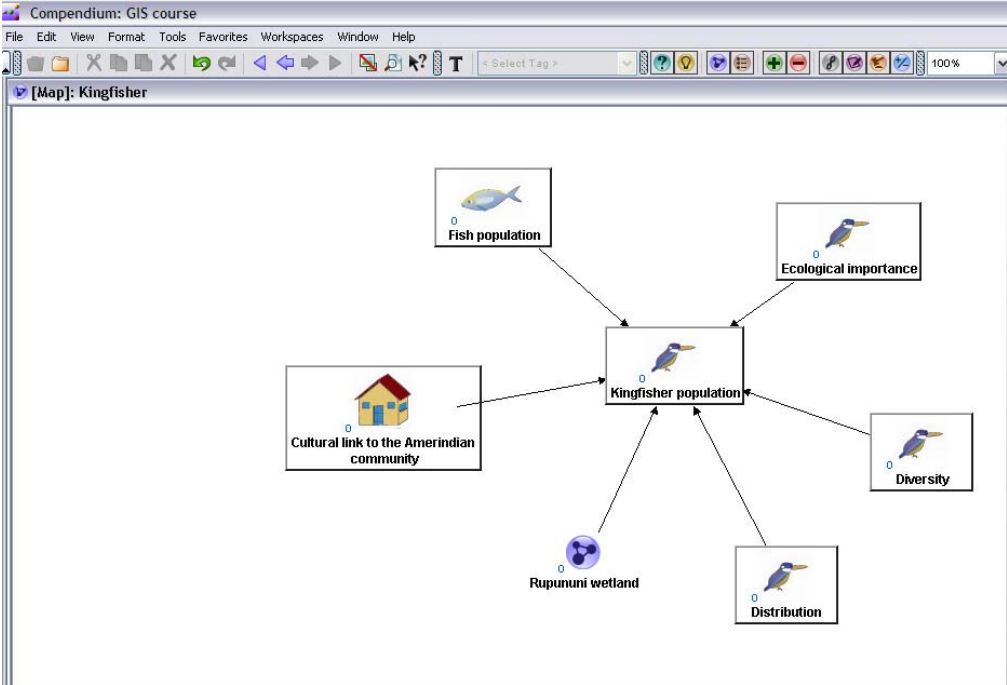
Figure 7. An example of a set of Compendium maps related to discussions around the Rupununi river catchment.
Publications
Reynolds, Martin; Berardi, Andrea; Bachler, Michelle; Buckingham Shum, Simon; Bernard, Calvin; Mistry, Jay and Ulrich, Werner (2007). ECOSENSUS: developing collaborative learning systems for stake-holding development in environmental planning. In: OU Conference Curriculum, Teaching & Student Support Conference, The Open University, 2 May 2007, Milton Keynes, UK
Berardi A., Bachler M., Bernard C., Buckingham Shum S., Ganapathy S., Mistry J., Reynolds, M., and Ulrich W (2006). The ECOSENSUS Project: Co-Evolving Tools, Practices and Open Content for Participatory Natural Resource Management. Second International Conference on e-Social Science. 28-30 June 2006, Manchester, UK.
Berardi A., Bachler M., Bernard C., Buckingham-Shum S., Ganapathy S., Haynes L., Mistry J., Reynolds, M., Roopsind I., and Ulrich W. ECOSENSUS (Electronic/Ecological Collaborative Sensemaking Support System). RGS-IBG Annual International Conference, ‘Participatory Techniques Showcase’, 30 August – 1st September 2006, Royal Geographical Society with IBG, London, UK.
Berardi A., Bachler M., Bernard C., Buckingham-Shum S., Ganapathy S., Haynes L., Mistry J., Reynolds, M., Roopsind I., and Ulrich W. ECOSENSUS – A participatory spatial decision-support tool for natural resource management. RGS-IBG Annual International Conference, ‘Participatory GIS’, 30 August – 1st September 2006, Royal Geographical Society with IBG, London, UK.
Berardi A., Bachler M., Bernard C., Buckingham-Shum S., Ganapathy S., Mistry J., Reynolds, M., and Ulrich W (2006). The development of an open content course on natural resource management: A virtual team production between Guyana and the UK. The International Journal of Education and Development using Information and Communication Technology (IJEDICT), Special Issue on the Caribbean, August 2006. Vol 2, No.2.
Berardi A., and Reynolds M. (2006). The ECOSENSUS Approach to Sustainable Management of the Rupununi, Guyana; A learning system linking people and the environment. Open Systems Research Group Seminar, 6th June 2006.


